
3-D Maps of Your Property
3-D Virtual Reality representation of your property GPS enabled UAVs for aerial surveying is very cost effective in comparison to hiring an aircraft and with the ability to produce a 3-D Virtual Reality representation of your property, Pixel Airways offers an...
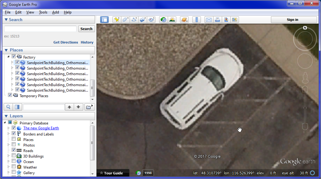
Google Earth in HD
Increase The Resolution of Google Earth Ever wish you could crank up the resolution of the images you see in Google Earth? Even with the newest upgrade from Landsat 7 to Landsat 8 with 1 pixel per 7 meters, Google Earth cannot match 1 pixel per inch. Google images are...
Odenwald Forestry – Tree Felling
I’d like to thank John of Odenwald Forestry for letting me video him in action. It was a beautiful spring day and while this looks from afar like random tree cutting, this area cedar trees are being attack from beetles. By clearing these the sick trees out, the...
FREE Real Estate Aerial Video
Construction in progress $FREE, Zero, Nada, Zip! If you have a showcase home or building that you want aerial photos and videos of, we may, at our expense photograph it for free and provide raw unedited, untouched-up images/video. This is just marketing 101 —...![]()
Hi-Res Video?

How to get high resolution videos in two clicks...